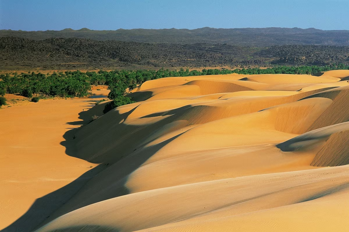
The great raid between Adrâr and Tagant
Between sheer cliffs and endless dunes, explore Mauritania's two Saharan jewels
Duration
15 days
Ideal seasons
Jan, Feb, Mar, Oct, Nov, Dec
Style
Expeditions
Comfort
rustique
Travelers
Couple, Solo, With friends
The spirit of travel
This great car expedition takes us through the two most beautiful regions of Mauritanie. This journey is a link between the Sahara and the Sahel.
Coming from the west, after crossing the endless regs lined with ribbons of sand in the Inchiri, then the scattered massifs of the Amsaga, the Adrâr mauritanien stands out with high steep cliffs that stretch between Kediet ej Jill to the north and the depression of Khatt méridional to the south, spanning nearly 600 km.
The series of sandstone plateaus (quartzitic sandstone) belongs to the southwestern edge of the Arawane-Taoudeni basin.
To the east the plateau is lost under the powerful dunes of the Maghteir and erg Wârane.
The Tagant is a land of contrasts: both Sahel and Sahara. It is a mountainous region located in the center of Mauritanie. The true pronunciation, that of the local people, is moreover: Taganet.
Less compact than the Adrar, the Tagant is formed by a set of sandstone plateaus ranging from 100 to 450 m in altitude, higher in the south of the massif, and separated from each other by gorge valleys or widely open ones, in which small oases are established with their palm groves.
This journey is of an easy difficulty level.
The stages of your journey
Highlights
Day-by-day itinerary

International flight to Nouakchott
Indicative flight proposal: Royale Air Maroc.
We take off in the late afternoon for the Mauritanian capital via Casablanca in Morocco. Once formalities are completed, we welcome you in the hall of the Nouakchott airport terminal.
By a short transfer into the city, we reach our hotel in the middle of the night for well-deserved rest.

Heading towards the Adrar plateau
After leaving the city and its suburbs, we take the beautiful paved road that heads northeast towards the mining town of Akjoujt.
The Trarza region and the Atlantic coast are now behind us, the vegetation changes and becomes increasingly Saharan.
The vast sandy plains of Inchiri lead us towards the somewhat surreal town of Akjoujt. A mining industry is present there and, since the Chalcolithic, Man has been extracting copper, gold and other materials.
Gradually the landscape changes. You are now driving in the Amsaga region.
In the distance, to the east, the dark barrier of the Adrar begins to take shape. You pass the great alluvial plain of Yagref and the village of Aïn Ahel Taya. The road crosses the first escarpment of the Adrar.
The city of Atar founded in the 17th century in the border plain (bâten) that stretches north of the great cliff, is protected from sand by its geographical location.
It is the most important city in the Saharan zone. It was formerly an emirate city a garrison town for the Americans then the French and finally the capital of the region.

The Erg Magtheir

Between Erg Maghteir and El Beyyed
The erg Makhteir is one of those powerful dune massifs running from western Algeria, west of the Saoura to the shores of the Atlantic.
Beginning under the general name of Erg Chech, it ends its course in the ocean under the name of Azefal.
A cape of the Adrar plateau stands like a ship's bow, the tarf Tazazmout. It marks the entrance to the corridor leading to a sacred place of the Sahara in Mauritanie, El Beyyed.

Wadâne, Tin Labbe and Meyateg
Along a very rough track, we climb onto the eastern Adrâr plateau. A detour to the west allows us to admire one of the most beautiful parietal sites of the Adrâr at the head of Ouan an Amourt. Hundreds of engraved bovids … and, with some luck … a watch hanging from the branch of a small acacia …
The Azilal plateau was in the past a great gazelle hunting territory, even addax today completely disappeared.
The Taguenze buttonhole opens onto the Guelb Er Richat and after crossing this large rocky reg, we reach the first swells of the Richat.
The flattened dome of Guelb Er Richât, which appears during the secondary period, is located at the borders of the dark mountains of the Mauritanian Adrâr, to the west, and the vast expanses of stones, rock slabs and dunes of the Taoudenni basin, to the east.
The strange system of concentric ridges of the Richât is so imposing that it appears today on all maps, even at small scale.
Richât is the plural of richa (feather), a term that perfectly describes the appearance of its ridges whose leeward flanks are striped with tongues of sand and which dominate the deep plains where goats and camels graze… when, by chance, it has rained.
Because of its very size, it was only revealed much later, by Professor Théodore Monod in 1934.
Indeed, no one, whether coming from the rugged plateaus of the north or from the dunes of Majabat Al Koubra (Monod, 1958), to the south and southeast, could imagine that these low ridges would be organized into such a perfect concentric system, vaguely elliptical with 22 km and 25 km in diameter, emerging from a buttonhole opening of 45 km, the Taguenzé, opened in the sandstone plateau.
We leave the different circles of Richat heading south, towards Hassi Thiba and the traces of the former Portuguese fort of Aguadir. Saharan forests are relatively developed in this area. As we dive towards the sands, the palm groves of Meyateg struggle to survive.
We reach Wadane and the very beautiful valley of Tin Labbe.
The ksar of Wadâne, (Ouadâne) which was founded, it is said, the same year as Tichîtt (1141), would derive its name from the Arabic word meaning "two riverbeds" (wadân). The details according to which these two wadis would be the wadi of dates and the wadi of sciences are greatly to the credit of the city.
The ancient city is mentioned in writing in the middle of the 15th century in a Portuguese travel report but it remains difficult to form a precise idea of the city's beginnings despite its position on the western axis of trans-Saharan caravan traffic.
Wadâne is a dense urban center, of ksourien type, formerly surrounded by a very secure fortified enclosure that resisted all foreign forces until the arrival of the French.
The dominant tribes are the Kounta, the Ida ou El Hadj, the Chorfa, the Amgârîj and the Aghzazir.

Tanouchert, the mega barrier of Herour and El Kheouiya
We now skirt the erg Warane which runs along the Adrar plateau from the eastern confines. It marks the border, difficult to cross by car, of the immense empty space, the Majabat Al Koubra.
The Tanouchert palm grove nestled in its setting of dunes crosses the centuries while maintaining a certain lustre.
To the west, the mega sandstone ridge of Herour winds its way through the heart of the dunes. Like the Zarga massif, Herour has a fascinating geomorphological history.
We reach the El Kheouiya semi-nomadic camp. Established on the banks of a major wadi, our hosts have marked our history.
The semi-nomadic camp of El Kheouiya is settled there during major droughts. The camp has been organizing itself for the past few years: development of goat and camelid herding (from 2 camels in 1993, now a herd of over 70 animals), creation of a school in 1994, birth of a small palm grove associated with gardens in 1999 and, now, some permanent dwellings.
"But we, we stay under the tent" Atfeil, the camp leader, assures us …
The links we maintain with the different families of the camp are close and greatly friendly.

Erg Warane and Zarga, passage through Chinguetti
An early morning wake-up allows us to visit this Saharan ksar, private libraries, gardens...
We continue our transfer by vehicle in an increasingly sandy environment. The "track" passes north of the dune massifs of Wârane and Afam el Merzrougât.
45 km from Chinguetti, the semi-nomadic camp of El Rhéouiyya welcomes us.
The ancient city of Chinguetti
Chinguetti was founded by the Ida Ouali around 1525, upstream from Abweyr, which has since disappeared and was itself created in 1261.
The probable etymology of the toponym shingitî would be:
well of the horse, from Soninké: si: well + n: of + gede: horse.
Chinguetti was the most active commercial center and the most important city of the Western Sahara. It was considered by Mauritanians as the 7th holy city of Islam with its 11 mosques, its 100 wells and its circle of scholars.
In 1675, a massacre perpetrated by part of the Ida-ou-Ali led to the breakup of the group whose survivors founded another ksar in the Tagant, Tidjikja.
Today only a single mosque remains and the memory of prosperous periods…
The main tribes that make up its population are the Ida-ou-Ali, the Laghlal and the Oulad Gheilan.
With their narrow and winding streets, their many dead ends, their low and dark houses made of local materials, their near absence of squares and communal spaces, Chinguetti and Wadâne have a structure of old ksour densely huddled around their mosques.
Through the soft sand of the Chinguetti wadi we reach the western tongue of the Warane erg. A few barchan fields are now developing on the sandstone plateau.
The mega-ridge of Zarga blocks our path and raises its eroded rocks submerged in the sands.

Between Adrâr and Tagant
Leaving the small Zarga mountain massif, we pass near the Aoueloul meteorite crater. We reach the new road at the height of Aïn Safra. It takes us quickly into the north of Tagant after crossing the El Khatt depression.
We arrive at Rachid between palm trees and gueltas.
Rachid was founded at the beginning of the 18th century by the important Kounta tribe.
The ancient city, destroyed several times over the past centuries, lies in ruins. Since 1968, a new village has been built on the other side of the wadi.

The East of Tagant, Monkeys and Baobabs
We find the first doum palms, an important climate marker. We continue our journey towards Tidjikja.
Tidjikja is the capital of the region. It is said to have been founded in the 17th century by the Ida-ou-Ali who came from the Adrar.
Like Chinguetti, it was a religious center, but of lesser importance.
We continue our trail towards Megsem Bou Bkar. This place is laden with history and is also important for the Mauritanian entity.
We are on the eastern barrier of the Tagant, to the east, the Aouker erg stretches as far as the eye can see. Many Neolithic villages, tombs and paintings that you climb on foot on the rocky massifs.
In a fissure oriented west-east, a baobab subsists far to the north of the current distribution area. We set up camp not far from the village of El Gheddiya.

Transept from east to west, the Tamourt en Najje, N'Beika
N'Beika, 20 km from Moudjéria, is located on the right bank of the Tamourt valley and occupies a splendid site between dunes and rocks.
Wildlife is important in the Tagant, although often nocturnal.
Carnivores: striped hyenas, jackals (whose yelping is often heard during the night), foxes, fennecs, wildcats (Felis sylvestris). Note that the cheetah has only disappeared since the 1960s or 70s.
Rodents: hares, squirrels, goundis, jerboas and gerbils. Also note their neighbors the hyraxes.
Various animals: porcupines (Hystrix cristata), hedgehogs, monkeys (patas and hamadryas).
Gazelles are rare as they are decimated by hunting. Their tracks are occasionally noticed (dune and plateau region of the Er Roueissat area).
Reptiles: various snakes (Moïla, Schockari), vipers (Vipera cerastes, sand viper and Cerastes cerastes, horned viper), various reptiles including many dobs (Uromastix), agamas and monitors.
Scorpions can be frequent, especially during hot periods.
Birds are relatively abundant: ravens, falcons, owls, doves, bee-eaters, as well as a large number of European or African passerines, often with very colorful plumage.
Certain gueltás harbor fish such as Clarias or catfish.
A few, more important ones, such as the one at Matmata near N'Beika, in the southwest of the Tagant, still hide some crocodiles.
The area is very interesting and we will not fail to go, towards the south, walk towards the small characteristic peaks. Many gueltas where monkeys come to drink. We resume the track in the direction of Igavan.
We arrive at the end of the day at N'Beika, on the edges of the Tamourt n'Najj.

Crocodiles, baboons and an ancient city
The objective is to go to the gueltas of Matmata on foot after a short car transfer. Observation of Nile crocodiles is possible. We dedicate time to this as the various sites are very interesting.
We return to N'Beika passing through Tamourt Bouraga. It is possible to observe, on the water, a multitude of birds.
The track takes us to Ksar El Barka in the northwest of Tagant.
Ksar el Barka (1690), like Rachid (1723) are the ksour founded in Tagant by the Kounta in relation with Touat (Algeria).
The Kounta form a tribe that claims to be of both Arab and Sanhaja origin, guardians of Islamic orthodoxy and propagators of the Kadriyya Bekkaiyya way. Their haratines cultivate the palm groves while they themselves are active caravan merchants.

The vast spaces between Tagant and Adrar
Ksar El Barka → Aouinet Et Tiliski
We leave behind the large Yagref spillover area and the Tamourt. The track climbs onto the plateau before descending into the El Khatt depression.
In the distance, Guelb Mouïche serves as our landmark to cross the rocky ridges of Tamga. We now drive between sand and rocks.
Aouinet and Tiliski is a tiny isolated palm grove lost between Adrâr and Tagant.

The western edge of the Adrâr
We climb up along the rocky ridges of the western Adrar. We reach the Bou Aboun depression, a place that can, if rainfall has been plentiful, be a little Paradise where sedentary and nomadic populations coexist in perfect harmony.
A beautiful black reg allows us to access the fractures of the western Adrâr.
The western part of the Adrâr in Mauritanie offers great landscape diversity.
The plateau is crisscrossed by a dense network of faults of tectonic origin where wadis flow. Here the blonde ergs run aground against the uplifted blades of black sandstone. Erosion has shaped the landscapes over millennia.
At the bottom of the valley, the softness of the palm groves stands out from the steep and austere mountain massifs. In secret crevices are set gueltas with crystal-clear waters.
Sedentary cultivators, established in the palm groves, continue their traditional life in this Sahara that can be generous. On the surrounding plateaus, nomads seeking pasture for their herds rhythm their time with long seasonal movements in search of life-saving rains. Their white or brown tents are there, hidden from view, in the movements of the terrain.
Here in Adrâr, the complementarity between these two necessities of life takes on its full force. We cross the territory of the Oulad Sassi tribe of the Ideichily confederation.

Oasis and gueltas of the Adrar
We ascend the Hnouk gorge to reach the large agricultural village of El Maaden. Following the gorge, we emerge at the first palm trees of the opulent Amatlich region. Having reached the plateau, we now overlook the El Meddah valley. Here, wedged between the vast dunes of the Amatlich erg and the purple cliffs of the Adrâr, the town of El Meddah develops and prospers despite its isolation. Mauretanian society lives in near self-sufficiency and at a rhythm established for centuries.

Return to Nouakchott then international flight
We leave behind the dunes of Amatlich, Along the beautiful paved road we reach the town and its suburbs.
Following your flight schedule to France, we will transfer you to the Nouakchott-Oumtounsy International Airport.
Practical Information
Registration is considered firm and final after payment of a deposit of 30% of the total price and acceptance of the specific terms of sale.
The balance must be paid no later than 45 days before the departure date.
See our specific terms of sale for full details.
In the event of cancellation by the traveller, the following fees apply:
- More than 60 days before departure: 40% of total price (deposit retained)
- Between 60 and 30 days before departure: 50% of total price
- Less than 30 days before departure: 100% of total price
We strongly recommend taking out cancellation insurance. See our specific terms of sale for full details.
The information below concerns travelers who are nationals of the European Economic Area (EEA), Switzerland, and Canada traveling to Mauritania for a tourist stay. As entry rules may change, we recommend verifying this information with the official authorities before your departure.
Passport
To enter Mauritania, your passport must be valid for a minimum of six months after the date of entry into the country and must have at least one blank page for immigration stamps.
The document must be in good condition (no damaged, torn, or altered pages).
Visa
Nationals of the European Economic Area, Switzerland, and Canada must in principle have a visa to enter Mauritania. This visa can be obtained:
from the embassy or consulate of Mauritania in your country of residence before departure,
or, depending on current conditions, upon arrival at Nouakchott International Airport (visa on arrival), for a stay of up to 30 days.
It is strongly recommended to inquire with the Mauritanian authorities or the competent embassy before departure, as visa application procedures may change.
The authorities may request:
an exit ticket from the territory (return or onward flight),
proof of sufficient financial resources for the duration of your stay,
a hotel reservation or an invitation letter.
Health and vaccinations
No vaccinations are officially mandatory to enter Mauritania, with the exception of the yellow fever vaccine if you are arriving from a country where this disease is endemic.
However, several vaccinations are strongly recommended by health authorities:
Hepatitis A and B
Typhoid
Meningococcal meningitis
Rabies (depending on planned activities)
Update of your routine vaccination schedule (diphtheria, tetanus, poliomyelitis)
Antimalarial prophylaxis is recommended for the entire Mauritanian territory. Consult a doctor or an international vaccination center before your departure.
Security and registration
Mauritanian authorities may require the registration of foreign travelers with local police or gendarmerie services within 48 hours of arrival, particularly outside the capital. It is advisable to inquire about the obligations in place at the time of travel.
Due to the security situation in certain regions of the country, it is recommended to consult travel advice issued by the authorities of your country of residence before departure.
Traveling with children
Minors must hold their own valid passport covering the duration of the stay.
In some European countries, when a minor travels without one of their parents, an exit authorization from the territory may be required according to the regulations of their country of residence.
Other nationalities
Entry conditions may vary depending on nationality. Travelers concerned should inquire with the embassy or consulate of Mauritania in their country of residence.
To participate in our trips, it is strongly advised to be insured for evacuation assistance and medical expenses abroad.
Your local agency encourages you to review the specific policy developed with our partners CHAPKA ASSURANCES and AXA ASSISTANCE.
To subscribe to insurance, learn about coverage and rates, follow the link below.
CAP EXPLORER: The comprehensive insurance solution designed for a worry-free journey!
Choose the plan that suits you best:
Explorer'Multirisque
Explorer'Annulation
Explorer'Assistance
Explorer' Complémentaire Carte Bancaire
Specific to our trips, we strongly recommend subscribing to one of them.
If you choose to subscribe to one of these plans, the policy detailing all coverage and claims procedures are available on the insurer's website.
Your local agency will be aware of this, but only the participant is responsible for complying with claims reporting procedures. The participant should therefore keep this policy with them throughout their trip.
Chapka — Cap Explorer
Our insurance partnerTravel with peace of mind with our partner Chapka. Cancellation, repatriation, medical expenses, baggage… All the coverage for a worry-free trip.
Travel with peace of mind — I'll handle the insuranceFrequently asked questions
A tourist visa is required and is issued upon arrival at Nouakchott Airport or at the consulate. Your passport must be valid for at least 6 months beyond your entry date. The security situation requires heightened vigilance. Before booking your trip, please check with the consulate or embassy of your destination for entry requirements applicable to your nationality.
Go to the My Trips section to find all your projects.
You can send a message to your host directly from the Tea Lounge.
For a tailor-made quality trip, budget between 180 and 300 euros per day and per person, including accommodation, meals, 4x4 with driver and English-speaking guide. International flights (500-800 euros return) are additional. The desert, the Sahara train and the beaches offer unique experiences.
Your documents are accessible in the Documents tab of your trip.
Absolutely. We adapt each itinerary to travellers' profiles. For families, we prioritise relaxed paces, family-friendly accommodations, fun and educational activities, and comfortable private transfers. Our English-speaking local guides know how to capture children's attention with age-appropriate anecdotes.
It's simple. You exchange with our local team to define your wishes, budget and dates. You receive a detailed itinerary proposal within 48 hours. You adjust every detail together until you reach the perfect version. You confirm and travel with peace of mind. Your local agency remains available 7 days a week throughout your trip.
In case of emergency, contact your local agency immediately.
Payment is generally made in two installments.
Our agency is part of the Nomadays network, registered in France. You benefit from APST (Association Professionnelle de Solidarité du Tourisme) coverage, which protects 100% of your funds. Secure payment, repatriation insurance included, and English-speaking assistance 24/7 on the ground throughout your stay.
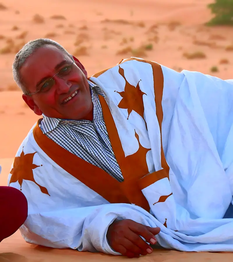
Let's talk about your adventure — Adrar
Craftsperson of journeys in the heart of Mauritania, based in Atar
Mauritania is a country that reveals itself with respect and patience. My role is to help each traveler approach it in the best conditions, with confidence and curiosity.
— Isselmou